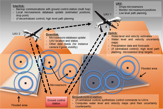
The objective of this research project is to solve the problem of estimating flash floods (a distributed parameter system) using a swarm of UAVs (Unmanned Aerial Vehicles).
More precisely, we are interested in the problem of computing the best UAV trajectories that maximize our level of information on the current flood state, given UAV performance and initial position constraints. The problem involves the computation of UAV trajectories over a fixed time horizon, and the fusion of their possible measurements into model. Our present focus is to conceive computationally fast, yet sufficiently accurate solution methods to allow real-time computation of UAV waypoints during flood events.